Fall Drives
A first look at fall color near Asheville, NC
In the early fall, trees begin changing color at the highest elevations surrounding the Asheville area, so head out on these scenic drives in late September and early October. Visit our weekly fall color reports to stay up-to-date on the most colorful foliage.
Read MoreScenic Route #1: Grandfather Mountain/The High Country
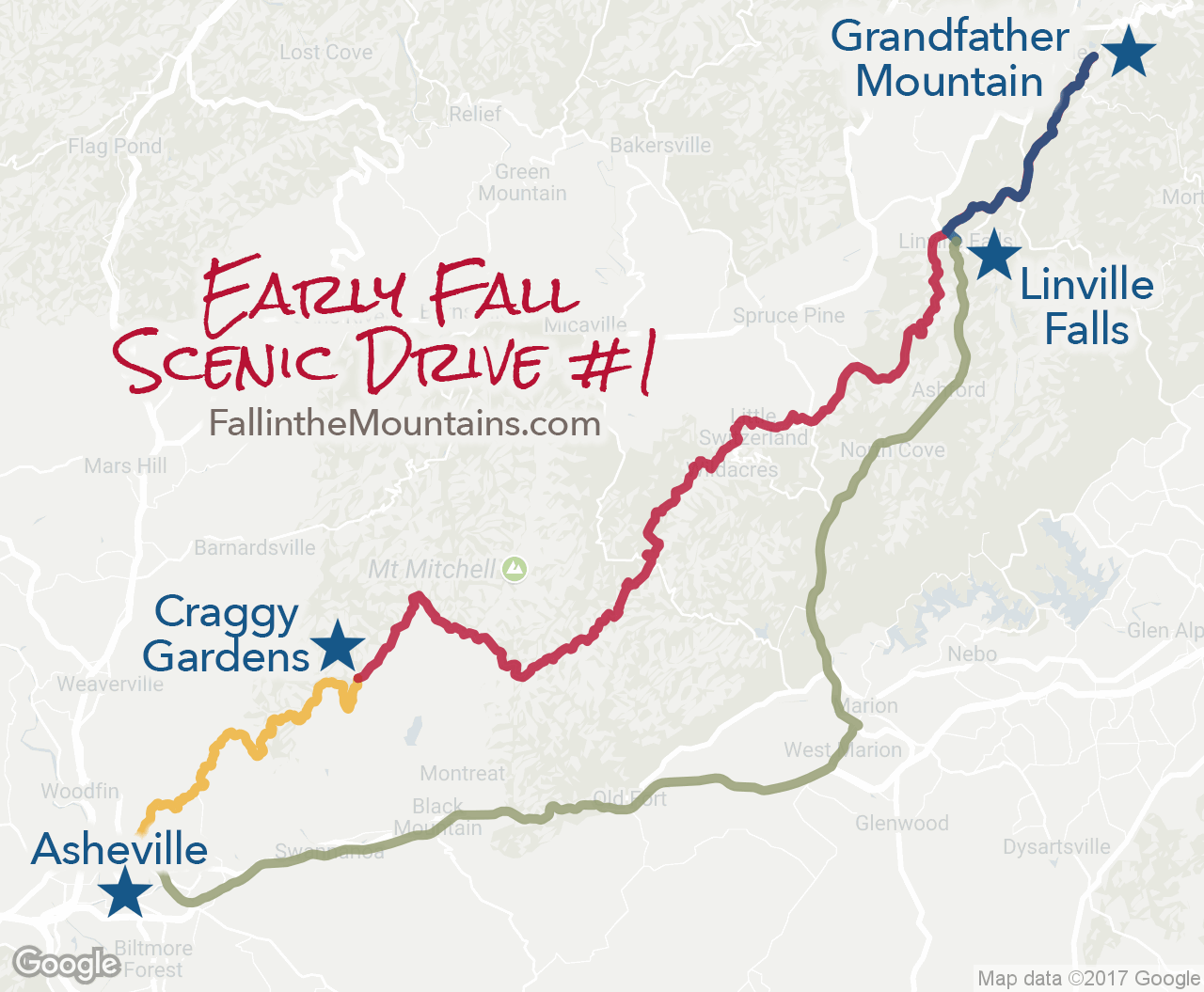
Located at Blue Ridge Parkway milepost 305, you can view native animal habitats, enjoy hiking and picnicking, and test your courage on the mile-high swinging bridge that also provides a great vantage point for viewing autumn’s rich colors. You can get to Grandfather Mountain a number of ways, and see interesting points and fabulous color along the way, no matter which route you choose.
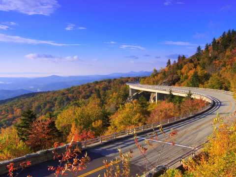
- Option #1 — Take the Blue Ridge Parkway north from Asheville and visit Craggy Gardens on the way at milepost 364, and then marvel at the Linn Cove Viaduct (pictured above) at milepost 304.
- Option #2 — Take I-40 East to Marion, then Hwy 221 north to Linville Falls at milepost 316.
- Option #3 — Take I-40 east to Morganton, then Hwy 181 north to the Parkway, passing Table Rock on the way.
Scenic Route #2: U.S. Highway 19
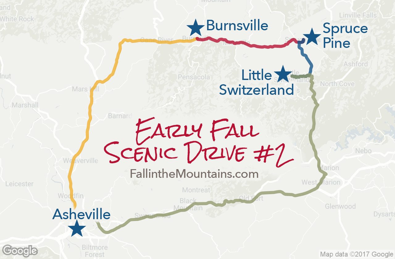
From Asheville, take US 19/23 north from downtown, and follow 19E to Burnsville. If you have time, take a break in Burnsville to enjoy its quaint shops and galleries. Then, continue your drive along 19E to the town of Spruce Pine, stopping along the way to visit the North Carolina Museum of Minerals and to enjoy the spectacular views of the Black Mountains and Mount Mitchell, the highest peak in the eastern U.S. at 6,684 feet.
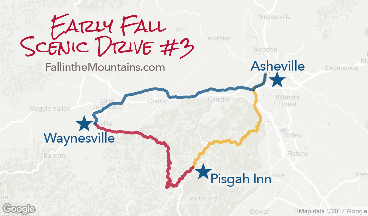
Scenic Route #3: Pisgah National Forest
Take the Blue Ridge Parkway south from Asheville toward Mount Pisgah at Milepost 408, where you will find picnic areas, hiking trails and the popular dining room at the Pisgah Inn, with its perfect view of Looking Glass Rock. At milepost 411, turn onto US 276 toward Waynesville. You will pass through the magnificent Pisgah National Forest, which affords a spectacular view of Cold Mountain, made famous by the novel and motion picture of the same name. Continue into Waynesville and circle back to Asheville.
Blue Ridge Parkway Drives
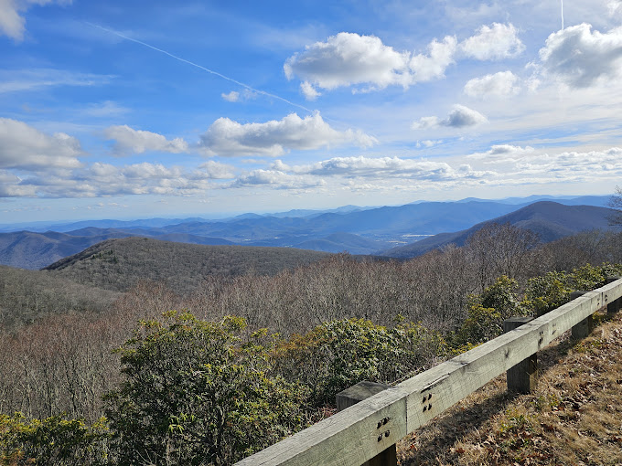
The Blue Ridge Parkway is part of the National Park Service and is known as America’s Favorite Scenic Drive. The 469-mile ribbon of road weaves around the peaks of the stunning Blue Ridge Mountains connecting Shenandoah National Park (Virginia) and Great Smoky Mountains National Park (North Carolina). As the Parkway approaches Asheville, it offers breathtaking views of some of the highest peaks east of the Mississippi River and access to the area’s best hiking trails. The Parkway is easy to explore with no admission fee and frequent, paved overlooks.
Read MoreTop Things to Do on the Blue Ridge Parkway
1. Scenic Drives: The best and easiest way to explore the Blue Ridge Parkway is to go for a drive! Drive for 10 miles or 50—it’s all up to you! And, it’s easy to create an experience that fits with your itinerary of other things to do in Asheville.
2. Hiking: The Blue Ridge Parkway is known for providing access to some of the best hiking trails in the nation. Whether you’re looking for a short, easy hike or a more challenging trek, you’ll find it on the Parkway. The forested trails lead to everything from 360-degree views to thundering waterfalls. See our guide to the best Blue Ridge Parkway hikes. Find your perfect Asheville hiking trail! Use our Asheville Hike Finder to easily filter by distance from downtown, trail length and difficulty level.
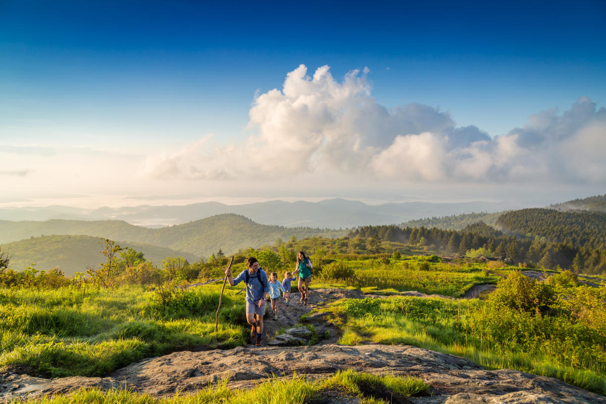
3. Picnicking: The dramatic views found on the Blue Ridge Parkway make for unforgettable picnic spots.
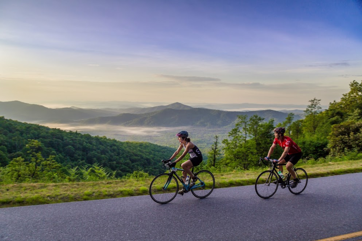
4. Biking: Bike the Blue Ridge Parkway for an outdoor adventure, and workout, like no other. See our guide to road biking adventures.
Top Places to Visit on the Blue Ridge Parkway
From natural wonders to an art gallery/shop, these are highlights of the Blue Ridge Parkway near Asheville. Distances from downtown Asheville are shown in parenthesis.
North of Asheville
- Craggy Gardens — Milepost 364.4: Breathtaking views await you here at elevation 5,640 feet. Craggy Gardens is home to a National Park Service visitor center, shop and restroom facilities. (24 miles, 35 minutes)
South of Asheville
- Folk Art Center — Milepost 382: This popular stop on the Parkway offers you the opportunity to view and purchase some of the region’s best arts and crafts. The Folk Art Center hosts craft demonstrations and events throughout the year. (6 miles, 10 minutes)
- Blue Ridge Parkway Visitor Center — Milepost 382: Pick up maps, ask questions, see interactive exhibits and purchase souvenirs. (6 miles, 10 minutes)
- Mount Pisgah – Milepost 407.6: See Asheville’s most iconic peak up close and personal. (26 miles, 40 minutes)
- Graveyard Fields — Milepost 417: This area, named for its unique landscape, offers relatively easy hiking trails to access to two waterfalls. (37 miles, 55 minutes)
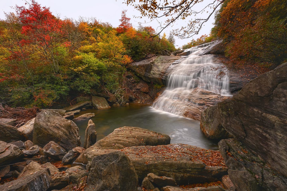
- Black Balsam — Milepost 420.2: Black Balsam is a local and visitor favorite for hiking, especially on the popular Art Loeb Trail. (40 miles, 1 hour)
- Devil’s Courthouse — Milepost 422.4: A large parking area provides a view of this unique rock formation. A strenuous hike takes you to the top for near 360-degree views. (42 miles, 1 hr. 5 minutes)
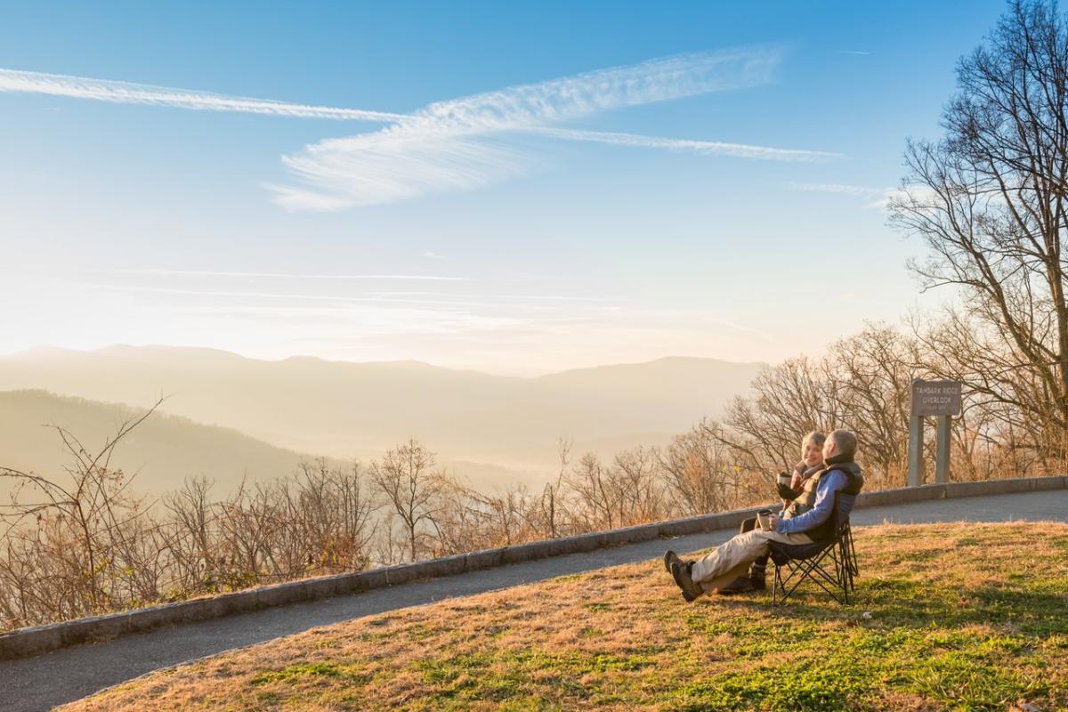
Plan Your Visit to the Blue Ridge Parkway
What to know about the Blue Ridge Parkway
- COST: It is FREE to drive the Blue Ridge Parkway. There is no admission fee.
- HOURS: The Blue Ridge Parkway is open 24 hours a day, 7 days a week year-round. However, the Parkway may close due to snow or ice. For real time road information, please see the interactive road closures map on the National Park Service web site.
- HOW TO NAVIGATE: There are stone markers at every mile along the Blue Ridge Parkway. These numbered mile markers are your guide for locating top attractions and overlooks.
- SPEED LIMIT: The Blue Ridge Parkway has a speed limit of 45 MPH, making for a leisurely drive. There are many paved overlooks where you can stop to rest, see the view or take photos.
- GAS: There are no gas stations on the Blue Ridge Parkway. But gas is available just off the Parkway at several major intersections with US or state highways. We recommend filling up your tank before driving on the Parkway.
- VEHICLES THAT CAN DRIVE THE PARKWAY: All non-commercial vehicles are welcome on the Blue Ridge Parkway.
How to get on the Blue Ridge Parkway in Asheville
In the Asheville area, there are four main entrances to the Blue Ridge Parkway. There are roadside signs before and at each of these entrances.
- US Highway 70 and Blue Ridge Parkway Milepost 382.6. Close by: Blue Ridge Parkway Folk Art Center, East Asheville, Interstate 40
- US Highway 74A and Blue Ridge Parkway Milepost: 384.7. Close by: Blue Ridge Park Visitor Center, the town of Fairview, East Asheville, Interstate 40
- US Highway 25 and Blue Ridge Parkway Milepost 388.8: Close by: Biltmore (three miles north), South Asheville
- NC Highway 191 and Blue Ridge Parkway Milepost 393.6: Close by: The North Carolina Arboretum, Asheville Outlets, Interstate 26.
Waterfall Drives
6 Drive-By Waterfalls: A Windshield Tour for All to Enjoy
Looking Glass Falls
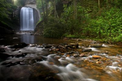
This 60-foot beauty in the Pisgah National Forest is one of the most photographed waterfalls in the South, and it is only 35 miles from Asheville! Find plenty of parking along US Highway 276, an accessible observation deck and stairs to the base of the falls. It’s named for nearby Looking Glass Rock, where water freezes on its sides in the winter and glistens in the sun like a mirror.
Soco Falls
This twin waterfall along Highway 19 has long been revered by the Cherokee Indians and is located on the edge of the reservation. Two creeks cascade into a lush cove filled with rhododendrons and towering trees. A short walk takes you to an observation deck. It’s a short drive from the Blue Ridge Parkway near milepost 455.7.
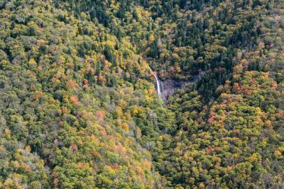
Glassmine Falls
From the overlook at Milepost 361.2 on the Blue Ridge Parkway, see this ribbon of water cascading down a rock cliff across the valley. Located about 25 miles north of Asheville near Craggy Gardens, it is most impressive after some rain. Glassmine is named for an old mica mine that was nearby.
Toxaway Falls
Many drivers cruise scenic Highway 64 across the bridge by the Lake Toxaway Dam without realizing a 200-foot waterfall is right beneath them. Park on either side of the bridge and take the ridgetop walkway along the road to look down at the water flowing over colorful bedrock down the gorge. You’ll see why this highway is also designated as the NC Waterfalls Byway, and you can continue driving to see the next two waterfalls.
Bridal Veil Falls
This one cannot be more convenient when traveling the scenic NC Waterfalls Byway. Located along US Highway 64 near the town of Highlands, you can’t miss the waterfall and paved area behind the 60-foot delicate cascade that glistens in the sunlight as it flows over the cliff above.
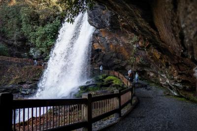
Dry Falls
Not only can you see this 75-foot waterfall from an accessible observation deck, it offers the very rare treat of walking behind a powerful cascade! A short paved trail goes underneath the cliff overhang so you stay dry (hence the name!). It’s just a mile past Bridal Veil Falls on Highway 64.
